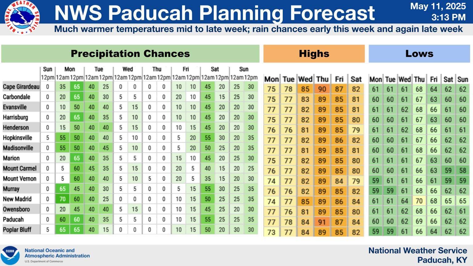
Scattered showers and warm temperatures are in store for western Kentucky along with the chance for some severe weather toward the end of the week.
Lead Forecaster Allan Diegan with the National Weather Service in Paducah says many areas in the region received rainfall late Sunday night into Monday morning. Diegan expects rain chances to remain throughout the week with high temperatures approaching the 90s by Thursday.
Meteorologists are also keeping an eye on a weather system that could bring severe weather on Thursday and Friday.
Diegan says they expect the first round of severe weather to arrive Thursday into the nighttime hours, but that forecast could change. The approaching cold front could result in thunder storms, hail, high winds and maybe even a few tornadoes.
However, Diegan says the severity of the weather system could wane due to warm air that may cap the atmosphere and suppress any storms that develop.
Then on Friday, Diegan says Thursday’s front will remain in the region and could result in more severe weather.
Looking toward next week, Diegan says they are expecting precipitation to be above normal while temperatures are set to be colder than normal. The week may start with some severe weather, but Diegan says they are not certain yet.
As warmer weather approaches, Diegan shared that the weather service’s heat advisories will change from “Excessive Heat Watch or Warning” to Extreme Heat Watch or Warning.”