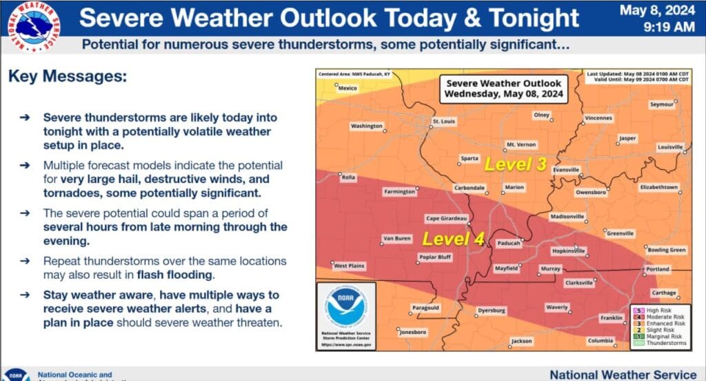
With all of western Kentucky under a moderate risk—a level four out of five—for severe weather today, the National Weather Service in Paducah is urging people to be prepared and weather alert.
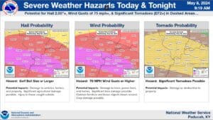
In a conference call Wednesday morning, Warning Coordination Meteorologist Christine Wielgos says all hazards are on the table with any severe storms that develop today, including large hail, damaging winds and possibly strong, long-tracked tornadoes.
The timing is tricky—with a front moving into the area sometime around mid-day, storms could begin for some folks early in the day, bringing those severe risks, before a cold front roars through later this afternoon into the evening. Weilgos says the threat is an all day one, so people shouldn’t be quick to let their guard down.
Weilgos says this an early-summer severe threat that this region experiences every year, so everyone should have their severe weather plans in place and ready to roll when needed.
Stay tuned to the WHOP Family of Stations for any watches or warnings that develop with this severe weather system.