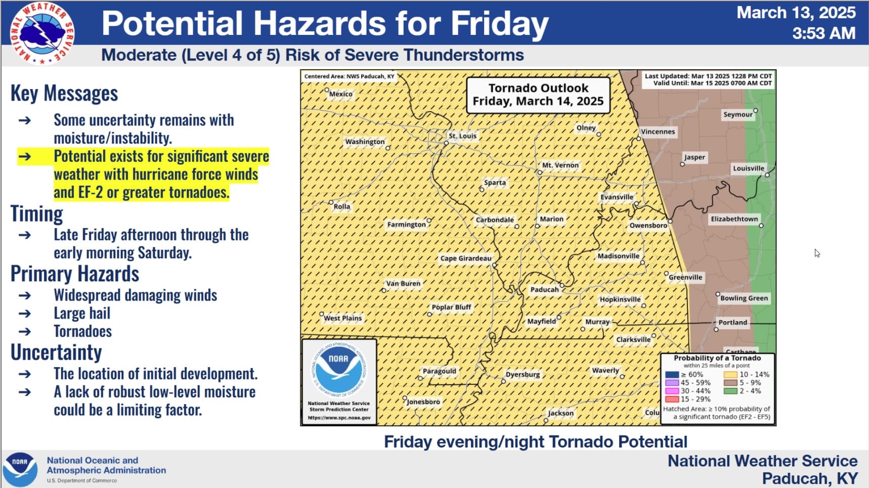
Following the work week’s calm weather, two storm systems bringing possible severe weather are set to impact the region on Friday and Saturday.
According to the National Weather Service in Paducah, the weekend may include heavy rain, damaging winds, hail, tornadoes and flash flooding. Severe weather is expected to impact the Pennyrile Region starting in the evening on Friday.
Christian, Todd and Trigg Counties are in an enhanced risk zone while areas to the west are in a moderate risk zone. Keith Cooley with the National Weather Service in Paducah says Friday’s storm system is set to move fast, so he advises people to react quickly if any tornado warnings are announced.
Hurricane-force winds are expected and the weather service has already issued a wind advisory from 1 p.m. Friday to 4 a.m. Saturday. Along with the high winds, Cooley says EF-2 tornadoes or higher could form late Friday night.
Since Friday’s storm system is set to move fast, Cooley says they are not expecting much flash flooding. Then the stormy weather is expected to return on Saturday a little before noon, and Cooley says these storms could result in some flash flooding in the Pennyrile region.
The region is expected to receive some heavy rain, possibly between one to two inches per hour. For more weather information check out the US National Weather Service Paducah Kentucky on Facebook.